Latest
Oct 27 · 42.22 pre-release: ladders and crowbar break-insOct 23 · First-person mods are not officially supportedOct 21 · The Indie Stone on Java mods: download responsiblySep 28 · Build 42.21 Stable: zombie duplication fixesAug 26 · Security fixes on every branchAug 17 · Servers now handle up to 254 playersJul 29 · Build 42 goes Stable

Points of interest in Project Zomboid

This page lists the landmark locations worth a trip in Build 42, apart from gun stores and military sites. It covers malls, prisons, hospitals, warehouses, tool stores, places for skill books, farms and the unique sites in the new western towns. Each entry says why to go and what makes it risky. Written for Build 42 (42.22), November 2026.

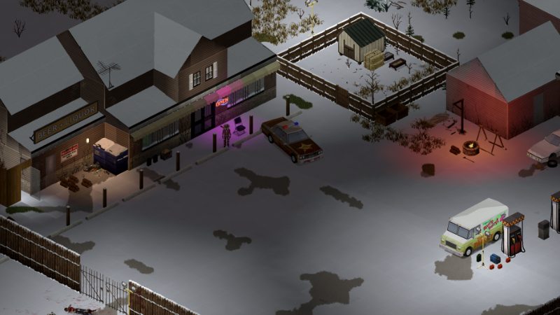
A town street in Project Zomboid
Large landmarks hold the most loot and the largest crowds.
01Part

The landmarks at a glance

Every place below is named or pinned by at least one guide written for Build 42. Coordinates are approximate world tiles that you can check on the map. No source gives zombie head counts, so the danger column is a relative rating that moves with your sandbox settings. Gun stores and army sites are on the gun locations and military bases pages.

LocationNearest townWhy goMain danger
Crossroads Mall, about 13930, 5830Valley StationMany shops under one roof; a staging point for LouisvilleTop density score in one hot-spot chart; noise carries through the halls
Grand Ohio Mall, about 13570, 1320Louisville, north-eastFood court, pharmacy, clothing and electronics shops (one source)Entrances on every side and a very large horde
Kentucky State PrisonWest of RosewoodArmory, infirmary, riot gear, toolsA fenced cell-block maze packed with zombies
Louisville General Hospital, about 12960, 2040 (one source)Louisville, centerThe largest stock of medical suppliesMaze-like wards in dense blocks
Cortman Medical, about 10880, 10020MuldraughA small clinic you can clear earlyHighway traffic outside
McCoy's Logging, about 10320, 9320Muldraugh, north-westTools, generators, building materialsLarge lots that are hard to hold
Irvington Speedway, about 930, 13040 (one source)IrvingtonA unique race track siteHeavily infested (one source)
Coalfield, about 3490, 8190 (one source)Doe Valley Forest, north of Echo CreekWild West tourist town with a smith and farrier shopRemote; plan fuel for the round trip
Sunderland Hills Sanatorium, about 4040, 6490 (one source)Western interiorAbandoned medical complexIsolated, and its loot is not documented
02Part

Malls and prisons

Crossroads Mall sits about 1,300 tiles east of Valley Station (one source). One Build 42 chart of hot spots gives it the highest density score of any single site. Grand Ohio Mall is in the far north-east of Louisville beside the Ohio River. One guide lists a ground-floor gun store inside and calls the mall one of the last objectives of a run. A second large retail block is pinned near 13340, 3050 (one source).

Kentucky State Prison stands apart from Rosewood on its west side. One site pins it at two slightly different spots, 7776, 11793 and 7683, 11877, so use either as a rough target. The Rosewood police station has its own holding cells, which are a different place. Other sites that guides pin but do not describe: prison cells in north-west Louisville near 12410, 1590 (one source) and the Brandenburg Detention Center near 1385, 5877. The 42.20 release notes also mention an entirely new prison, an abandoned orphanage and a boy scout camp without saying where they are.

Opinion Treat both malls and the state prison as late targets. Go with a full tank, a planned exit and a cleared car park, and fight on foot rather than with gunfire indoors.

03Part

Hospitals and medical centers

Louisville has the only full hospitals that guides name: Louisville General Hospital in the center and St. Peregrin Hospital further south, near 12410, 3670 (one source). Smaller clinics are a safer source of bandages, disinfectant and pills for first aid.

  • Muldraugh: Cortman Medical, on the east side of town. Two sources name it.
  • Rosewood: a medical clinic near 8090, 11520, plus a clinic room in the school (one source).
  • West Point and Riverside: a downtown pharmacy each, near 11920, 6790 and 6470, 5260 (one source).
  • Ekron: Family Medical Center and a Pharmahug store (one source).
  • Brandenburg: a walk-in medical clinic (one source).

Hospitals are among the buildings that can have generated basements in Build 42 (one source). See basements.

04Part

Warehouses, storage lots and tool stores

Muldraugh has the best-documented industrial strip. The pins below come from one town map whose text and pin table differ by a few tiles, so treat them as approximate (one source).

PlaceTypeAbout
McCoy's Logging plantLogging factory and carpentry workshop10320, 9322
McCoy's logging warehouseWarehouse10250, 9433
Mass-GenfacThree-level warehouse with offices10619, 9315
L&B WarehousingTwo warehouses10722, 10430
Secure Storage, U-Store It, Clark StorageStorage unit lots10614, 9371; 10686, 9836; 10704, 10141
Hardware storeTool store and storeroom10610, 10316

Elsewhere, the same site pins a tool store in downtown West Point near 11970, 6900 with a storage unit yard on the south-east edge, a tool store in downtown Riverside near 6360, 5320, and a multi-level factory warehouse south-west of Riverside near 5610, 5960. Irvington has Hobbs & Perkins Hardware (one source). Louisville's warehouse blocks hold tools, building materials and vehicle parts (one source). What to take is covered in tools.

05Part

Bookstores, libraries and schools

Bookstores and libraries are the main shelves for skill books. Schools add a library room, and one guide points to the Rosewood school for skill magazines and the generator manual. Container contents are never guaranteed.

TownPlaceAbout
RosewoodBookstore on the main street; school with libraryBookstore: sources disagree, 8087, 11500 or 8080, 11360. School: 8330, 11600
West PointBookstore downtown; school with library11890, 6880; 11350, 6770 (one source)
RiversideBookstore in the strip shops; school with library6430, 5260; 6440, 5450 (one source)
MuldraughLibrary with offices; Muldraugh Elementary10687, 10327; 10618, 9985 (one source)
LouisvilleLouisville State University12410, 2260 (one source)
Brandenburg, Ekron, IrvingtonMaj. Saunders Middle School, Ekron Community College, Irvington ElementaryNamed by one guide, no coordinates

One guide names the Rosewood bookstore BookNaked (one source). Louisville also has three movie rental stores for skill tapes, one of them near the mall.

06Part

Farms and rural supply

Build 42 added livestock, and it turns up around farms and barns in the rural west. Named sites all come from one guide (one source):

  • Ovo Farms, a chicken operation east of Echo Creek.
  • Brott Cattle Farm and factory farms east of Irvington.
  • Farming & Rural Supply in Irvington, the closest thing to a feed store that any source names. No source lists its stock.

Farmhouses around Ekron and Brandenburg are also described as farm base spots. Animals can wander or die before you arrive, so bring a trailer and feed plan from the animals page.

07Part

The horse track, unique sites and water

Louisville's horse track is on the west side of the city. The only Build 42 reference found is a movie rental pin described as near the horse track, around 12430, 2820, with a riding school at about 13040, 2820 (one source). The animal lists checked for this page do not include horses.

The developers' Build 42 feature list confirms a Wild West tourist town, a docked steamboat, a race track, a large lakeside guesthouse and an abandoned sanatorium. Guides match these to Coalfield, the P.S. Delilah at Brandenburg near 2048, 5687, Irvington Speedway and Sunderland Hills Sanatorium. The guesthouse is not named or placed by any source. A campground east of Irvington has backpacks, tents and sleeping bags (one source).

For water, the Ohio River runs along the north edge past Riverside, West Point, Brandenburg and Louisville, and the Salt River lies east of West Point. Fallas Lake and Doe Valley Lake are the named lakes in the west. All of them serve for fishing and as a water source once the taps stop.

08Part

Quick answers

Where is the mall in Project Zomboid?

Crossroads Mall is east of Valley Station at about 13930, 5830. Grand Ohio Mall is in the north-east of Louisville at about 13570, 1320.

Where is the prison in Project Zomboid?

Kentucky State Prison is just west of Rosewood, around 7700, 11800. Guides also pin prison cells in north-west Louisville and a detention center at Brandenburg.

Is there a hospital outside Louisville?

Guides name full hospitals only in Louisville. Other towns have clinics and pharmacies, such as Cortman Medical in Muldraugh and the Family Medical Center in Ekron.

Where can I find farm animals in Build 42?

Look around farms and barns in the rural west. One guide names Ovo Farms east of Echo Creek for chickens and Brott Cattle Farm and factory farms east of Irvington.

Where is the race track in Build 42?

Irvington Speedway is north-west of Irvington, pinned at about 930, 13040 by one map guide. It is reported to be heavily infested.

Where is the best place for tools and building materials?

McCoy's Logging and the warehouses and storage lots along the Muldraugh strip are the best-documented stop. Tool stores are also pinned in West Point, Riverside and Irvington.

Locations and coordinates come from Build 42 map guides, mostly PZfans town maps and Build 42 Guide, checked against the developers' feature list. Coordinates are approximate and many places have only one source; no source gives zombie counts. Sources: PZfans: Knox Country map guide · PZfans: Louisville POI list · Build 42 Guide: new towns · The Indie Stone: Build 42 features overview · Supercraft: Louisville guide. Your game is the final word: if it disagrees with us, tell us and we will fix the page.